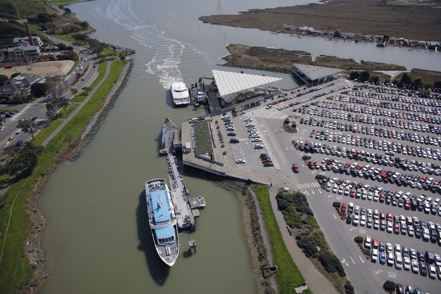
Study Overview

The Golden Gate Bridge, Highway and Transportation District (District) is conducting the Larkspur Service Expansion and Parking Study (Study) to review ways to increase ferry ridership and reduce traffic congestion on Highway 101 in Marin and Sonoma counties and in the Larkspur Landing area. The Study will consider how the ferry terminal ground transportation area can accommodate increases in ridership with adequate parking, transit connectivity (bus and rail), and walking and bicycling, for overall reduction in traffic backup and congestion in the area.
When Study planning began in 2019, ferry ridership had hit a maximum peak capacity. Average weekday ridership was over 8,000 passengers on a fleet of seven ferries that supported 42 average daily crossings. Several times a week, ferry passengers were turned away for lack of parking by late morning. Congestion on Highway 101 was worsening. Though congestion had mostly vanished at the start of the pandemic in March of 2020, vehicle traffic on Highway 101 and in the Larkspur Landing vicinity has started to increase again.
The future beyond the pandemic is uncertain, but the Bay Area’s economy has proven resilient in the past. Economists expect that there will be a rebound to the economy that will bring a return of traffic congestion and its negative impacts. By leading the Study now, the District is taking steps to support the region in planning and preparing for recovery and a post-pandemic future.
Goals of the Study
Specifically, the Study will include information on:
- Examining how the Larkspur Ferry Terminal can accommodate further increases in demand as the Bay Area ferry network expands and travel on the 101 corridor continues to grow;
- Expanding the Larkspur Ferry Terminal parking and landside access;
- Forecasting traffic circulation in Larkspur Landing vicinity and along Sir Francisco Drake Boulevard with future increases in ferry demand.
Informed by feedback from residents, transit riders, public agencies and other stakeholders, the Study will consider a variety of alternatives and develop a comprehensive evaluation of the environmental impacts that the proposed project would likely cause, and conceptual mitigation. The Draft Environmental Impact Report (DEIR) is anticipated to be available for public comment and review by late 2025 or early 2026. The Final Environmental Impact Report (FEIR) will be prepared and a final project will be approved by the District in late 2026 or early 2027.
Study Timeline
The Study is scheduled over three phases.
Phase 1: 2024-2025
- Alternatives Development and Screening
- Environmental Technical Studies
- Identification of Proposed Project
Phase 2: 2025-2026
- Environmental Evaluation and Draft Environmental Impact Report
- Public Review of Draft Environmental Impact Report
- Preliminary Design Study
Phase 3: 2026-2027
- Final Environmental Impact Report
- Regulatory Permitting
Study Documents
Stay Informed